Is it difficult for you to find the correlation between what you see on the nautical chart and your real vision?
Do you use a nautical GPS but cannot recognize destinations on the coastline profile?
ShoreView is the digital nautical guide with Augmented Reality to locate yourself on the sea, explore the coast safely and discover points of interest.
Is the perfect visual assistant for coastal navigation for skippers and sailors with their own or rented boat.
With ShoreView you have the superpower to sail seeing what others can't.
Get the app for free and enjoy the coast as you have never imagined before!
··········
Is it difficult for you to recognize destinations in the profile of the coast?
ShoreView makes it easy for you: press and holds on the map to mark a specific destination that you want to identify and lift your mobile to be able to locate it on the coastline with your own eyes. ShoreView helps you find the concordance between the 2D map and what you are really seeing and in front of you.
Do you want to know what the coast you are sailing on can offer you?
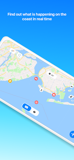
Very simple! Point your device at the coastal area where you are and ShoreView will provide you with tagged, real-time information about that area in question, helping you locate yourself at sea.
With ShoreView you can:
- Know the position and heading of your boat.
- Centre your position on the map.
- Mark a point by holding down your finger on the map, to later be able to locate it with your real vision.
- Make "check" with your camera viewfinder to locate the point you have selected in your real vision.
- Anchor a point on the map so as not to lose sight of it in your augmented reality.
- Unpin a point to continue exploring other possible destinations.
- Tap on an Augmented Reality button to know its position and distance.
- Know the position of the different points of interest on the map knowing their distance and bearing from your position.
- Lock the map horizontally.
- Explore by zooming in on the map to find those reference points of interest in the form of icons that help you locate yourself on the sea.
- Click on the different icons that appear on the map to know their name, distance and bearing.
- Enjoy all the functionalities in night mode/reduced visibility.
- Visualize with Augmented Reality the toponymy of the area; its distance and heading.
- Scan the coast you are pointing at and obtain information in real-time of what you are seeing and what you have in front of you but that is difficult for you to recognize.
- Use a compass/bearing compass.
- Get your pack and enjoy points of interest on the British Virgin Islands, the Caribbean islands, Spanish Mediterranean coast and the Balearic Islands.
ShoreView is much more than a nautical GPS, compass or nautical chart. Now you just have to keep your finger pressed on the map to mark a specific destination that you want to visualize and lift the mobile to be able to locate it on the coast with your real vision. Ditch the traditional nautical charts and make the move to ShoreView.
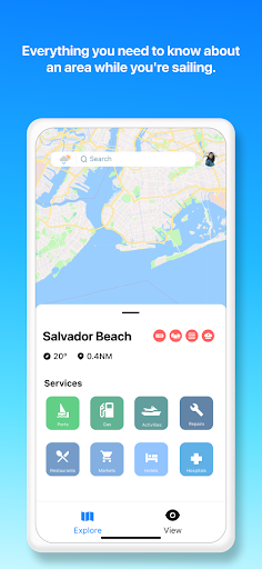
The navigation charts are useful but they do not give you information about the coast in real-time. With ShoreView you can easily find services and activities at your destination. Point to the coast with the Augmented Reality function and you will know what each area offers you before you arrive.
Find attractive tourist spots both on the coast and in the sea: restaurants, beach bars, beach clubs, rental of pleasure boats, ruins, monuments, panoramic visits, sandy and stone beaches, snorkelling areas, natural attractions, caves…
Say goodbye to classic routes, nautical GPS and navigation charts and get ready to enjoy the British Virgin Islands, the Caribbean Islands, Spanish Mediterranean coast and the Balearic Islands by locating yourself on the sea, sailing safely and discovering points of interest.
Welcome to boating with Augmented Reality!
ShoreView
Maps&Navigation
Shoreview S.L
How to install XAPK?
Use APK Gamer App
Get old version APK(XAPK) for Android
Download
Description
What's New in the Latest Version 2.2.7
New Points of Interest for the Spanish Coast: We have added information about auxiliary and lateral marks, light signals, floating aids, cardinal marks, main channels, new hazards, leading lights, isolated danger, sector lights, special marks, traffic signals, and navigable areas, with new icons for easy identification.
We have fixed the issue that caused the deletion of the selected point of interest when changing the map style.
Information
Related Tags
You May Also Like
High Quality Games
-
 i.M(아이.엠) - 프리미엄 카니발 택시 호출 서비스Maps&Navigation
9.9
GET -
 巴士到站預報 - hkbus.appMaps&Navigation
9.9
GET -
 Egypt MetroMaps&Navigation
9.9
GET -
 Porter Driver Partner AppMaps&Navigation
9.9
GET -
 PassApp DriversMaps&Navigation
9.7
GET -
 Nala TaxiMaps&Navigation
9.7
GET -
 WHIP LIVE Bike & Moto RoutesMaps&Navigation
9.7
GET -
 BluSmart: Safe Electric CabsMaps&Navigation
9.7
GET

